Category 5 Hurricane Katrina Heading For New Orleans-10am Sunday
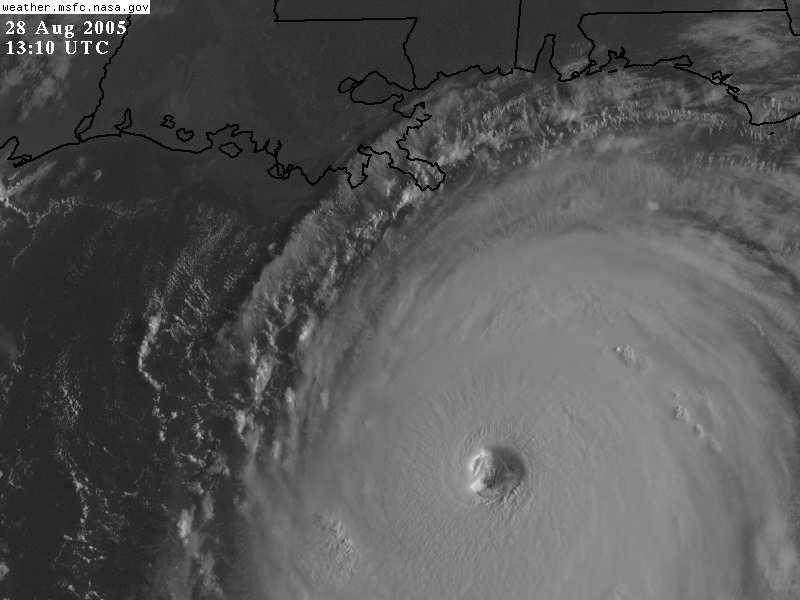
Well, things are looking even more dangerous than before. The Hurricane Hunters just flew into Katrina and found wind speeds of 160 MPH at the surface. This makes Katrina a Category 5 hurricane...the strongest on the scale. This also makes Katrina the most powerful hurricane ever in the Gulf of Mexico. As a Meteorologist, I am extremely impressed with Hurricane Katrina because of the way the storm is strengthening. It is unfortuante but there will be serious loss of life on the Gulf Coast where the Hurricane makes landfall. The damage should be at least as bad if not worse than Hurricane Andrew that struck Homestead, Florida years ago. The National Hurricane Center is even saying this will be a catastrophic Hurricane. We know that most homes, trees and structures will be completely wiped out where Katrina makes landfall, but we can only hope that people heed the warnings and move WELL inland. The levees of Lake Ponchatrain along with the storm surge is expected to inundate New Orleans under 25 feet of water, possibly. This would wipe out a lot of the city. Factoring in the wind speeds of 160 MPH with gusts to 190 MPH, things are not looking good.
The scariest part of this is that all of the computer models continue to show the strongest hurricane I have ever seen heading directly toward New Orleans. I've seen a lot of storms over the years, but this is scary. It is off the chart in strength. In any case, Katrina is expected to plow inland during the day Monday as a Cat 4 or Cat 5 hurricane. I understand that the National Hurricane Center personally called the mayor of New Orleans to say that he is extremely concerned about this one.
Last evening, some BUOY's in the Gulf were measuring wave heights as high as 32.5 feet. No doubt they are even higher than that now. Not only will the Hurricane devastate the New Orleans and coastal Mississippi/Alabama areas with flooding and extreme wind damage, but Katrina is also moving right over the oil drilling rigs in the gulf. They ceased operations yesterday. This is called the "LOOP". The LOOP is the main terminal in the gulf that transports oil via pipeline to over 50% of the United States' oil carriers. Having this shut down (and potentially damaged) has a huge impact on gas prices. You thought they were high before?!?!
Here are some interesting websites to look at as Hurricane Katrina Bears down on New Orleans. It's not going to be a pretty ride for the folks down there and we need to keep them in our prayers.
Live TV Feed from New Orleans: (Click Here)
Latest Hurricane Track Map: (Click Here)
Latest Hurricane Advisory: (Click Here)
Latest Doppler Radar Loop from New Orleans: (Click Here)
Latest Satellite Loop of Katrina: (Click Here)
Latest Warnings/Statements from Louisiana: (Click Here)
posted by Howard Altschule at 8/28/2005 08:59:00 AM
![]()
![]()

0 Comments:
Post a Comment
<< Home