Thursday, September 29, 2005

Strong Winds Cause Wind Damage

Convective line moved through Albany at 11:45am. The strongest winds were in the 4 hours preceding this line. Numerous trees and power lines are down areawide. An Old Forge, NY spotter (in the Western Adirondack Mountains) reports "hundreds" of trees down resulting from both non-tstm winds and also tstm winds with the line that went through. Buffalo, NY gusted to 65mph earlier. Albany airport had a peak gust to 45mph so far this morning. These are typical wind speeds area-wide although there were likely gusts up to 60-70 mph in some higher elevations. Anyway, the line lost some of its punch as it approached the City of Albany. I expect it to maintain itself/strengthen as it moves east into New England becuase it is more unstable out that way. CT, NJ and NYC may get into the action also since the front is still west of there currently. The line may intensify and bring some of the strong winds down to the ground there as well.

Wind Gusts to 50-70mph Today!!

It appears that all of the ingredients will be maximized to give us a widespread severe wind damage event today. The synoptic winds right now are gutsing to 40-50mph without any storms nearby. The radar shows a thin, organized line of showers and isolated thunderstorms entering central NY. NWS has severe thunderstorm warnings everywhere out there now as the storms are producing confirmed widespread wind damage. They are moving toward the northeast at 60mph and have gusts in excess of 70mph!!! WOW. BUF just gusted to 65mph. Watch Box issued at 6:45am and the wind damage shading has been increased to 25%...almost Moderate risk of severe. Thus, I expect this line to continue and strengthen with a derecho-like event today producing tons of tree damage (already occurring) in gusts over 70mph in spots. (Most damage reports in western NY now have trees down countywide and "widespread" tree down in the reports). Should be a fun day.

Wednesday, September 28, 2005

Severe Weather Thursday?

For all you weather weenies out there.....00z Model data reminds me of other events where we have backed into a severe TRW squall line despite minimal instability. A very strong surface front will create plenty of lift on Thursday. 500mb vorticity will also be favorable and winds will be extremely favorable for severe wind gusts. MM5 and ETA suggests a line of heavy showers and isolated storms to race across upstate New York by midday and these may be enough to produce wind gusts of 50-70mph at the surface. I expect there will be SVR Warnings issued tomorrow across this area (and an outside chance of a watch). It's one of those situations where Severe Thunderstorm Warnings may be issued for plain showers with no lightning. That's just the best way to warn for 1 or 2 counties with damaging winds. And, with 850 winds of 50-70 knots, it won't take much to bring damaging gusts to the ground. In addition, there a very nice wedge of dry air at 700mb and this will enhance the severe potential. So, we shall see what happens, but I do expect a fairly active day tomorrow. And its not out of the question that a full-blown squall line (with bowing segments) organizes either. Here's to a good chase??!!

Tuesday, September 27, 2005

Katrina Photos are Bogus

The following article is from Stormtrack online. Fellow chaser Mike Hollingshead took these pictures while chasing in tornado alley. Someone stole them from his website and claimed they were pictures of Katrina. They are wrong.
--------------------
All of us seem to have that one family member or coworker who forwards every chain letter that they get, even when most of them turn out to be hoaxes. These gullible folks are now hurting one of Stormtrack's own, and we want to say: Enough! Nebraska chaser Mike Hollingshead is well known for his sweeping stormscapes. Unfortunately a handful of dishonest individuals (and companies!) have been plagiarizing his pictures (see examples at right) and and providing fabricated captions. Here are some of the most widely seen examples:
* A chain letter claimed these were pictures of "Hurricane Katrina coming in" * A chain letter claimed this was a giant tornado * A chain letter claimed these storms downed the Air France Airbus in Toronto

* A Texas television station illegally posted them, billing them as "Texas storms" * Arizona Skywarn Gallery has illegal copies on their front page, citing it as a "Canadian" storm. * PhotographersDirect is carrying illegal copies as stock photos. * Weatherwise magazine on page 16 of the Sep/oct issue printed 3 photos, giving credit to "Rod Loraas of Calgary".

Monday, September 26, 2005

Alabama Twisters on Video!!!

A series of severe thunderstorms rip across portions of West Alabama. Several cells produce tornadoes. The worst damage is reported in portions of Tuscaloosa County. What a monster tornado. This tornado is what us stormchasers refer to as a "wedge". It may end up being rated an F2 or F3 just from the looks of it (very wide base). Enjoy these home videos.

http://www.tuscaloosanews.com/assets/wmv/TL4393925.WMV

http://www.tuscaloosanews.com/assets/wmv/TL4391925.WMV

http://www.tuscaloosanews.com/assets/wmv/TL4392925.WMV

Finally, it is very rare that a TV station's tower cam catches a tornado live on TV...let alon ever. These guys at ABC 33/40 in Birmingham did an awesome job staying calm, getting the info. to the viewers and using their weather toys to warn the public. Nice job and Incredible video...watch below.

http://beta.abc3340.com/static/weather/video/tcltornado092505.wmv

Way to Go N.Y. Giants!!

Edison, NJ – With a hard-earned win under their belt, the Giants offensive line went on the road Tuesday to visit some men and women who also know a little bit about providing protection. In partnership with Sharp Electronics, the Giants continued their annual tradition of honoring local firefighters who regularly put their lives on the line to keep our communities safe through the Adopt-a-Firehouse program. Giants’ center Shaun O’Hara, tackle Kareem McKenzie, guard Dave Diehl, guard Jason Whittle, and tackle Lewis Kelly visited Edison’s IAFF local 1197/2883 firehouse, where members of eight local firehouses gathered.
The Giants players presented each firehouse with a plaque honoring their service and each firehouse received a Sharp big-screen TV with DVD capabilities. These televisions will allow the houses to utilize the newest fire service training programs, many of which are now delivered in DVD interactive formatting. Following the dedication, there was plenty of time for autographs, great food prepared by the firemen themselves, and even a trip around the block on a fire truck.
The camaraderie between the linemen and firefighters was evident. “Today was a great opportunity to go down and spend some time with these firemen,” said O’Hara. “What’s amazing is the parallels that we have with them as offensive linemen. They do a lot of the hard work, they are down there getting their hands dirty, and they don’t get a lot of credit for a lot of things they do. So, it’s great to be able to come down here and just see them and know how much they enjoy their work. It’s a job, but they enjoy it.”
The Adopt-a-Firehouse program is the New York Giants continuing effort to honor the firefighters who gave their lives on September 11, 2001. This event was the fourth in a continued partnership between the New York Giants and the Professional Firefighters Association of New Jersey (PFANJ). Each year, the Giants and PFANJ will team up to participate in the Adopt-a-Firehouse program. The Giants have also donated televisions in 2003 and 2004 to firehouses in Hackensack and Hoboken. In 2002, the Giants dedicated a newly renovated kitchen as they adopted the Rescue Company 1/Squad 4 firehouse in Jersey City.

Friday, September 23, 2005

Catastrophic Flooding in Major Cities

The National Weather Service in Lousiana has many flood warnings out calling for catastrophic flooding. This one caught my attention especially...WHOA:

FOR THE CALCASIEU RIVER NEAR SALT WATER BARRIER, THE LATEST STAGE WAS 2.9 FEET AT 8 PM FRIDAY. FLOOD STAGE IS 4.0 FEET. THE RIVER IS FORECAST TO RISE ABOVE FLOOD STAGE THIS EVENING, WITH A CREST NEAR 16.0 FEET SATURDAY MORNING DUE TO STORM SURGE. AT STAGES NEAR 13.0 FEET, THE RIVER IS AT ITS FLOOD OF RECORD. OVER HALF OF THE CITY OF LAKE CHARLES IS FLOODED.

Breaking News: Scott Steven's Quits to Investigate Japanese Mafia that "Created Hurricane Katrina"

It doesn't get any better than this....

POCATELLO - To the rest of the country, Scott Stevens is the Idaho weatherman who blames the Japanese Mafia for Hurricane Katrina. To folks in Pocatello, he's the face of the weather at KPVI News Channel 6.The Pocatello native made his final Channel 6 forecast Thursday night, leaving a job he's held for nine years in order to pursue his weather theories on a full-time basis.

"I'm going to miss that broadcast, but I'm not going to miss not getting home until 11 p.m.," Stevens said. "I just don't have the hours of the day to take care of my research and getting those (broadcasts) out and devoting the necessary research to the station."It was Stevens' decision to leave the TV station, said KPVI general manager Bill Fouch.
"When Scott signed his current contract, he told Brenda and me at the time that it would be his last contract," Fouch said Thursday. "We knew, but the timetable moved up because of all the attention (he's been getting.)"Since Katrina, Stevens has been in newspapers across the country where he was quoted in an Associated Press story as saying the Yakuza Mafia used a Russian-made electromagnetic generator to cause Hurricane Katrina in a bid to avenge the atomic bomb attack on Hiroshima. He was a guest on Coast to Coast, a late night radio show that conducts call-in discussions on everything from bizarre weather patterns to alien abductions. On Wednesday, Stevens was interviewed by Fox News firebrand Bill O'Reilly.
Stevens said he received 30 requests to do radio interviews on Thursday alone.Fouch said Stevens wanted to leave as quickly as possible because his "plate is full," and he needs to take advantage of the opportunities that exist now.
Stevens said he's received offers that he's not at liberty to discuss.Stevens, 39, who was born in Twin Falls, plans to remain in Pocatello, where his family remains. He said his family wishes him the best in his future endeavors.
It costs him hundreds of dollars each month to run his Web site, weatherwars.info, but he said that's a price he's willing to pay."There's a chess game going on in the sky," Stevens said. "It affects each and every one of us. It is the one common thread that binds us all together."
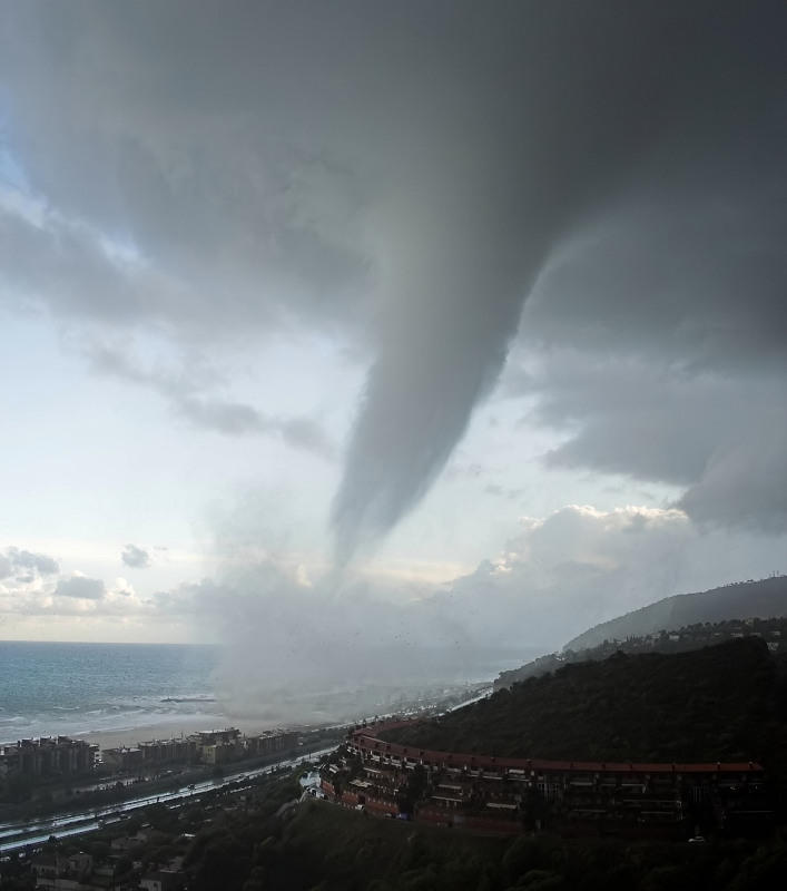
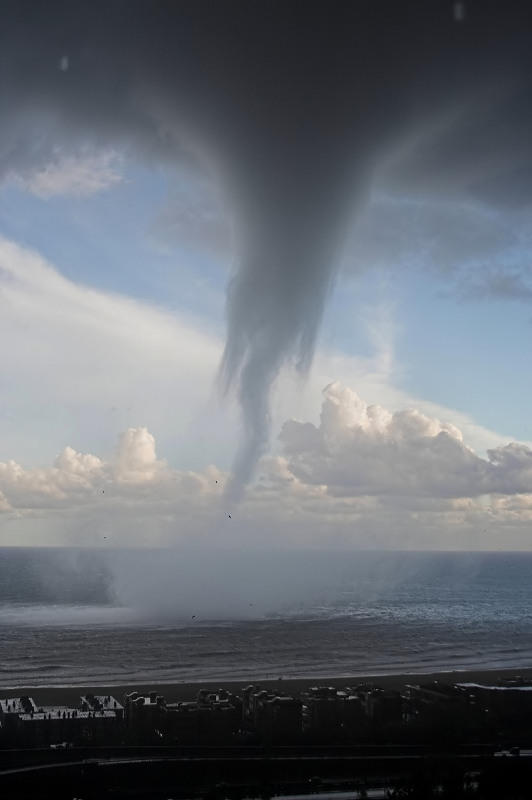
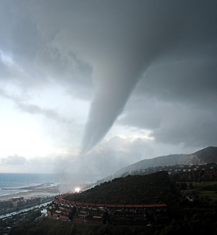
Although the theories espoused by Stevens - scalar weapons, global dimming - are definitely on the scientific fringe today, there are thousands of Web sites that mention such phenomena."The Soviets boasted of their geoengineering capabilities; these impressive accomplishments must be taken at face value simply because we are observing weather events that simply have never occurred before, never!" Stevens wrote on his Web site. "The evidence of these weapons at work found within the clouds overhead is simply unmistakable. These patterns and odd geometric shapes seen in our skies, each and every day, are clear and present evidence that our weather has been stolen from us, only to be used by those whose designs for humanity are rarely in alignment with that of the common man."
However, Stevens never discussed his weather theories on the air during his time at Channel 6 - an agreement he had with the station management. What the meteorologist chose to do in his off time was his business, said his manager of eight years.Fouch said he would miss Stevens, whom he described as energetic, easy-going and enthusiastic about the weather, but he is supportive of his decision to pursue his passion.
"His theories are his theories," Fouch said. "But, if you think about it - of all the TV weather people, he continues to be the most accurate. It isn't his theories getting involved with his professional job."For Stevens, however, the recent attention to his theories has been somewhat of a distraction from work."When there has been so much attention, it gets in the way of them doing their jobs and me doing my job," Stevens said.

Rita Update...Friday Afternoon

**Check Below Message for real-time Satellite and Radar Images**

The big R is approaching. The weather should be getting worse later tonight with the worst conditions around sunrise Saturday morning. Rita has not changed much this afternoon. WSR-88D (Doppler Radar) from Louisiana sure shows a nice eye wall moving 310 degrees (toward the Northwest). I agree that Rita will be a Category 3 or 4 storm as it moves inland early tomorrow morning, and my feeling is that landfall will be right in between Galveston and Port Arthur, TX. This will probably save Galveston and Houston from the worst part of the storm as it will be on the typically weaker left side of the storm. Port Arthur and areas near to it will get slammed. Galveston and Houston will still have its share of the problems but not as bad as it could have been.

At this point the weather computer models are of little help in determining the future track of Rita. The best thing to use is satellite and radar observations. This is why I am adjusting my landfall eastward by about 25 miles. Barring any last minute jogs to the left, I think this landfall forecast will verify.

Doppler Radar Loop Near Rita

Satellite Loop of Rita

Live NWS Warnings/Statements for Texas (incl. Houston & Galveston)

Thursday, September 22, 2005

Rita Update: Thursday

11am:
Not much change to the thinking in my previous posts. I'm glad people are evacuating well ahead of time. There will no doubt be people that stay, but hopefully most will learn the lessons from Katrina.

AT 10 AM CDT...1500Z...A HURRICANE WARNING HAS BEEN ISSUED FROM PORTO'CONNOR TEXAS TO MORGAN CITY LOUISIANA. A TROPICAL STORM WARNING HAS BEEN ISSUED FROMSOUTH OF PORT O'CONNOR TO PORT MANSFIELD TEXAS. A TROPICAL STORMWARNING REMAINS IN EFFECT FOR THE SOUTHEASTERN COAST OF LOUISIANAEAST OF MORGAN CITY TO THE MOUTH OF THE MISSISSIPPI RIVER. MAXIMUM SUSTAINED WINDS HAVE DECREASED TO NEAR 165 MPH...270KM/HR... WITH HIGHER GUSTS. RITA IS A CATEGORY FIVE HURRICANE ONTHE SAFFIR-SIMPSON SCALE.

9am:
Rita still at 170mph sustained winds with higher gusts. Almost all of the most recent computer models have around to my forecast thinking and have a direct hit on Galveston, TX and the Houston, TX area. Time for the people along the entire coastline within 100 miles of Galveston to GET OUT. Hearing that one computer model has a max projected storm surge of 38 feet. Unreal.

Wednesday, September 21, 2005

Hurricane Rita: 3rd Most Powerful Hurricane on Record


Hurricane Rita is now as strong as Katrina was and maybe stronger. Watch out Houston (see why below).

11PM Advisory: Rita: 175 MPH Winds Sustained!!!

GET THIS!!!! The 00z model consensus and extensions have all shifted markedly eastward. The GFS now tracks east of Houston by about 15 miles while the GFDL extensions bring the storm right over the City of Houston. The other models have also all shifted to the right quite a bit and are just to the left of Houston by maybe 15-20 miles. This is where the consensus track is also. Of interest also is the new GFS forecast of 175 kt (200 mph) maximum sustained winds in about 48 hours. The GFS and the GFDL (and extensions) both continue the strengthening for another 36 hours from now!!! IMO: The GFS has done the best job so far. The 18z GFS run nailed the more NW'erly jog this afternoon. If NHC doesn't reference the NW jog or model change in its 11pm advisory, I would be very surprised.

8pm EDT Wed.:
MAXIMUM SUSTAINED WINDS ARE NEAR 165 MPH...WITH HIGHER GUSTS. RITAIS AN EXTREMELY DANGEROUS CATEGORY FIVE HURRICANE ON THESAFFIR-SIMPSON SCALE. RITA IS MOVING TOWARD THE WEST NEAR 13 MPH PRESSURE HAS BEEN FALLING RAPIDLY DURING THE DAY AND THE LATESTMINIMUM CENTRAL PRESSURE RECENTLY REPORTED BY AN AIR FORCERECONNAISSANCE PLANE WAS 898 MB...26.55 INCHES. THIS MAKES RITA THETHIRD MOST INTENSE HURRICANE IN TERMS OF PRESSURE IN THE ATLANTICBASIN.

7:30pm EDT Wed:
The 18z GFS computer model run may be on to something!?!?!!! The Northwest Jog that lasted for 4 hours or so, was likely significant enough to change the track. Based on the following, the NHC MUST BE VERY WORRIED ABOUT THIS. A review of the 18z GFS (one of the most reliable models for the tropics IMO) shows a major shift in Rita's track. It brings Rita onshore with a DIRECT HIT on Houston, TX at 2pm Saturday. I believe it will be a strong Category 4 hurricane. Given the NW jog, I am putting a LOT more weight on the GFS and a landfall in and around Houston. FYI: It is common practice for forecasters to wait a little while to see if another model run continues the trend before making adjustments...especially in such a high profile situation. That said, I'll bet this is what the NHC is doing and might even anticipate a track shift to the north tonight or at 5am tomorrow if the trend continues!!!

HOUSTON, WE'VE GOT A PROBLEM!!!!

(More below)

MAJOR Hurricane Rita

Hurricane Rita is a Monster storm!!

At 1:00 PM EDT, the center of Hurricane Rita was located over the eastern Gulf of Mexico. Rita is becoming a monster storm (similar to Katrina) with sustained winds of 140 MPH. Rita is entering the area of the gulf called the LOOP, where the water temperatures are very high. Warm water is the source of energy for hurricanes. All of our reliable models call for Rita to strengthen to Category 4 and 5 strength. The models also seem to have a good handle on where Rita will make landfall. Right now, I believe landfall will be just south of Houston, TX...between Port Lavaca, TX and Freeport, TX. Houston will still see some major effects from the storm.

For all of the general public in Texas that may be visiting this site, here are some links to websites that have the official evacuation orders and shelter information. It is highly reccommended that the public pay close attention to these statements and heed their warnings and evacuation orders. Katrina caused major problems, and us storm chasers don't want to see anybody hurt or worse. Be prepared!!

Find some information here: General Hurricane Awareness and Tips: http://www.nws.noaa.gov/om/hurricane/index.shtml

Texas Warnings and Evacuation Info. (not necessarily complete, but official): http://iwin.nws.noaa.gov/iwin/tx/allwarnings.html

Latest Hurricane Center Advisory: http://www.nhc.noaa.gov/text/refresh/MIATCPAT3+shtml/211444.shtml

NWS Austin/San Antonio,TX: http://www.srh.noaa.gov/ewx/

NWS Brownsville, TX: http://www.srh.noaa.gov/bro/

NWS Corpus Christie, TX: http://www.srh.noaa.gov/crp/

NWS Dallas, TX: http://www.srh.noaa.gov/fwd/

NWS Houston, TX: http://www.srh.noaa.gov/hgx/ [/u]

Tuesday, September 13, 2005

Scott Steven's Says "Katrina" was a Man-Made storm

OK guys and gals, now I've seen it all. This may be the strangest thing you have ever heard about. It is even stranger than the tornado intercept vehicle that I was driving behind in Tornado Alley this past Spring.

Many of you might remember the uproar that was created by Scott Stevens, the "Weathercaster" that was on TV here in Albany, NY in the early 1990's. Mr. Stevens claimed he was a Meteorologist and said he had his BS degree in Meteorology. One day WRGB found out that he'd been lying about his credentials and abruptly fired him. I have recently come to learn that that this person is now working at KPVI and has some really out of this world claims. A U.S. News Reporter was recently watching Scott Stevens weathercast and reported that Stevens said Hurricane Katrina was a man-made storm and was created using human engineering and technology!!?!? In a nutshell, he claims that Hurricane Katrina, Ophelia and many other weather systems and phenomena are being created and manipulated by human beings with old engineering technology...and they have been for 30-40 years now. That's right, he's not sure if it's the Americans or the Russians that have this secret technology, but he is certain these storms and other weather phenomena are man-made and did not form naturally. Yeah...yawn, just what I thought too.

So, if you have an extra 30 minutes and want to read about his claims, here is his website. http://www.weatherwars.info/katrina.htm

I have attached a few quotes of his below. And you wonder why people don't trust the TV Weatherman. Live long and prosper my earthlings.
-----------------------------------------------
From our Good 'Ole Friend Scott Stevens (formerly of Ch.6 WRGB Weather):

"It is my humble opinion that Katrina was an inside job. Planned by the power Elite, not necessarily the Bush Administration but certainly by elements within, to introduce an element of change into American society; only time will tell as to the full extent of changes that they desire. All is not as it seems. Thanks for taking the time to consider these possibilities and to visit my site."

"Hurricane Ophelia continues this trend of manufactured weather. ALL of our weather now has some imprint of scalar technology contained within. The above image was taken Saturday September 10th 4:32pm Eastern. This is supposed to be the eye of Ophelia; once again displaying geometry that would be impossible to create naturally within a fluid environment."

Monday, September 12, 2005

HOT Stock of the Future

Here me now and believe me later. Picture a world where the glass windows of office buildings and the sunroofs of home are industrially coated with a window tint material similar to that on some vehciles. Then imagine if the "tinted windows" were really solar cells that were glazed on as a solar coating to generate electricity. This is in the developmental stage right now with a California company called "Xsunx". This process is one of the most promising and rapidly developing technologies around and is part of the shift to renewable energy that I believe is taking shape.

I've been following this high risk stock for about 6 months now. Today it took off. If you're looking for a good stock with a huge potential, consider "XSNX". BUT, please be careful to invest wisely. Yesterday, XSNX was 0.15 (15 cents) per share. Today it went up 100%...to 0.30 cents a share. This spike of 13 times the average volume was likely the result of the favorable articles printed in todays Wall Street Journal. The Journal also said an up and coming here in the Albany area, Daystar Technologies (DSTI) would also become successful.

Here is the stock site for XSNX: http://finance.yahoo.com/q?s=xsnx.ob
Here is the website for XSUNX: http://www.xsunx.com/

Enjoy and good luck.

Duct Tape This

As you may know, Mr. Brown, head of FEMA submitted his resignation today. Isn't there anybody qualified in the United States that wants the FEMA job. (Thanks to Keith Olberman's article on what he dug up).

From MSNBC.Com:
In another gesture symbolizing the continued confusion of the federal response, the man President Bush immediately named to succeed “Brownie,” proves to have been the same FEMA official who, two-and-a-half years ago, suggested that Americans stock up on duct tape to protect against a biological or chemical terrorist attack.

David Paulison, then the government's Fire Administrator, joined with the then-head of Homeland Security Tom Ridge, on February 10th, 2003, to say that duct tape and plastic sheeting should be part of any home's "survival kit" in preparation for a terrorist attack. That set off a run on duct tape at stores, and widespread criticism of the administration. It might have been the first time after 9/11 that a large number of Americans wondered if the government really knew what it was talking about when it came to disaster preparedness.

Sunday, September 11, 2005

Barcelona Tornado...Ay Carumba!!


Magnificent photos of a waterspout that moved onshore in Barcelona, Spain on 9/7/05. A waterspout is a tornado over water. Once it moves over land, it officially becomes a tornado. If you look closely, you will see debris being thrown around just before the waterspout moves onshore. This debris is likely whats left of either boats or roofs of buildings. The orange flash you see in the last picture is a transformer explosion caused by the tornado ripping through power lines and tansformers.

Friday, September 09, 2005

Hurricane Hunters in the "Eye" of Katrina


These awesome pictures come from the data gatherers and modelers of the US Air Force's Hurricane Hunter's and Orion P3 research planes. The Hurricane Hunters were based out of Biloxi, MS until the base was destroyed by this very hurricane. No word yet on where they have relocated to.

I Feel Ya Ophelia!!


Hurricane Ophelia is now moving slowly away from the Florida coast...for now. Days of sitting and spinning in the exact same location off the Melbourne, FL coast has taken its toll on the Hurricane. Despite a warm supply of Gulf Stream water that would feed the storm, Ophelia's fury has upwelled cooler water from the bottom of the ocean and this has caused the storm to weaken. As you may know, warm water over 80 degrees is what's required for a hurricane to strengthen. Rainfall totals in the area where Ophelia has been sitting stationary are now at 34.3". WOW. Pretty impressive rainfall for 1 storm.

The track and strength of Ophelia are problematic. She is on the move northeastward right now but will stall out, make a complete 180 degree about face, and head for the East Coast of the U.S. Interestingly, ALL of the models loop Ophelia around, strengthening it to a major hurricane and have it make landfall between Jacksonville, FL and Charleston, SC in about 5 days. We'll have to watch this one closely. (Photos courtesy of NHC and my friends at StormTrack).

And from the absurd file:
I'm hearing that yesterday's Price is Right had a grand prize in the Showcase Showdown that was a trip to New Orleans and a speed boat. Now, I know many of these shows are taped in advance, but you'd have thought CBS or the production company would catch this and pull the show out of rotation since it is such a blunder. As a result, many CBS stations switchboards have been bombarded with calls from irrate viewers. DOH.

Monday, September 05, 2005

Another Hurricane Brewing near Florida....

It is interesting to see that ALL of the computer weather models develop this tropical wave into a T.S. or hurricane over the next 48 hours. While most models keep the system moving slowly along the FL east coast, it is SCARY to see that the 06z GFDL model brings a compact but potent hurricane almost directly over NEW ORLEANS!!! This model run would bring the RF Quadrant (with the strongest winds and surge) right over the city. The good news is that the GFDL is the outlying model here and it most likely won't happen this way. It will also be interesting to see how strong this storm gets since it is over the Gulf Stream...but over waters that have been upwelled by Katrina a week or so ago. My forecast is that this storm develops into a high end T.S. or a low end Hurricane and meanders North or Northwestward along the FL coast...perhaps moving inland at some point between Ft. Lauderdale and Daytona, FL. I don't think this will become a severe hurricane but more of a nuisance flood producer perhaps with some winds that could cause some minor damage to trees, etc. http://www.goes.noaa.gov/HURRLOOPS/gulfir.html

Saturday, September 03, 2005

Crooked Cops?? You Decide

Crooked Cops in New Orleans? You decide. After you see this MSNBC video that surprises some of New Orleans finest, there is not doubt that the "police officers" give the good cops a bad name. Click the link below to view:

http://www.zippyvideos.com/8911023771013466/countdown-looting-in-walmart/

Friday, September 02, 2005

VERY Disturbed with Bush and the Federal Response!!!


'Nuff Said.

I'm usually not this harsh but after watching the news coverage of what's been happening (or not happening really) and hearing the mayor of New Orleans and other State Reps. pleading for help, I have become extremely disturbed and disappointed with our country's leaders. I really feel for the people of New Orleans (and surrounding areas) and wish there were something we could do that would bring immediate help to save lives. I can't for the life of me understand why our government took so long to send major aid, personnel and supplies to this ravished region. We should have sent at a minimum, 10,000-20,000 army and/or marine troops there on Monday to assist with rescue. With all of the looting that has been going on, that should have been the other wake up call to send these numbers of troops to keep the peace while rescue efforts were underway. People shooting at our helicopters that are trying to evacuate vicitims from a hospital?? Hell, we'll show you, I'm going to send in 20,000 troops to kick your Arss if you try that again? That would have been my response. I cannot believe that our President and federal commanders did not order these massive numbers to deploy to this region. It is unbelievable.

And now with the article below saying that the federal gov't will step in and "bolster" the rescue effort b/c it is unsatisfactory is just the icing on the cake. The ENTIRE nation knew that this needed to be done 5 days ago!!! Not 6 days after the event. Our President dropped the ball again in a huge way and reinforces my opinion that he is very unqualified to be our leader. I leave you with this: Where is the money, troops and aid that we've sent overseas now that this occurred in our own backyard? I feel for the people of New Orleans (and surrounding areas) and pray that god creates many, many miracles, because our incompetent President surely isn't doing much to help!!! http://www.msnbc.msn.com/id/9157866/